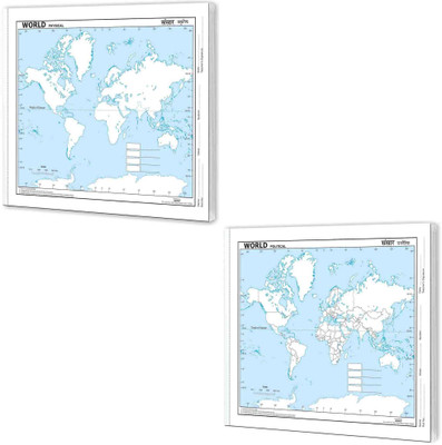
BIG - 100 WORLD POLITICAL OUTLINE MAP FOR SCHOOL And BIG - 100 WORLD PHYSICAL OUTLINE MAP FOR SCHOOL|Combo Of 2 Maps| World Political And Physical Outline Map For School(paper, GOWOO)
Quick Overview
Product Price Comparison
"The combo of the BIG - 100 WORLD POLITICAL OUTLINE MAP FOR SCHOOL and BIG - 100 WORLD PHYSICAL OUTLINE MAP FOR SCHOOL provided by Gowoo provides a comprehensive and educational resource for students to explore and understand the political and physical features of the world. These maps are designed for school use, offering a detailed and visually appealing representation of the global landscape. Measuring 11*8.5 inch each, these compact maps are perfect for student use. The BIG - 100 WORLD POLITICAL OUTLINE MAP FOR SCHOOL is a large map that shows the world's political divisions in a simple and easy-to-understand way. It is designed specifically for school students to help them learn about different countries and their borders.The BIG - 100 WORLD POLITICAL OUTLINE MAP FOR SCHOOL and BIG - 100 WORLD PHYSICAL OUTLINE MAP FOR SCHOOL offers numerous student benefits. It enhances their geographical knowledge and understanding, fosters critical thinking skills, and promotes global awareness experience by covering the world's political and physical aspects. The combo of political and physical maps helps students develop a contextual understanding of countries.These maps facilitate interdisciplinary connections by integrating geography with other subjects like social sciences, environmental studies, etc. Students can explore the connections between physical geography. The combo of maps is a valuable tool for exam preparation, helping students review and revise vital geographical concepts, political boundaries, and physical world features.Students can use these maps as a reference for research projects, presentations, or assignments, providing accurate and up-to-date information on global political and physical geography. The combo of BIG - 100 WORLD POLITICAL OUTLINE MAP FOR SCHOOL and BIG - 100 WORLD PHYSICAL OUTLINE MAP FOR SCHOOL is an essential educational resource that empowers students to explore, understand, and appreciate the complex and diverse world we live in. It encourages geographical literacy, critical thinking, and a global perspective, preparing students for active participation in an interconnected world."

